Millions of Americans planning Fourth of July celebrations may need to rethink their outdoor festivities as a potentially dangerous weather system sets its sights on Florida and the southeastern United States. This developing storm threatens to transform what should be a weekend of barbecues, beach trips, and fireworks into a soggy, wind-whipped disappointment for countless families.
The timing couldn’t be worse for the holiday weekend, as this weather disturbance appears poised to stall over one of the nation’s most popular vacation destinations just as families gear up for their Independence Day celebrations. From beach resorts to backyard gatherings, the approaching system has meteorologists issuing urgent warnings about the need for backup indoor plans.
Weather forecasters are closely monitoring this system’s development, as it represents the kind of unpredictable summer storm that can rapidly intensify and spread its impact far beyond its initial target area. The potential for this disturbance to strengthen into a named storm adds another layer of concern for holiday travelers and residents alike.
The storm’s threatening trajectory
A massive weather disturbance is currently stretching across Florida, spanning from the northeastern Gulf waters all the way to the Atlantic coastline. This expansive system shows no signs of moving quickly through the region, instead appearing likely to linger and potentially strengthen over the warm waters surrounding the state.
The storm system’s current position places it perfectly to disrupt holiday plans across multiple states, with its influence extending well beyond Florida’s borders. Meteorologists describe the system as particularly concerning due to its potential to remain stationary, allowing it to gather strength and dump enormous amounts of rain over the same areas for extended periods.
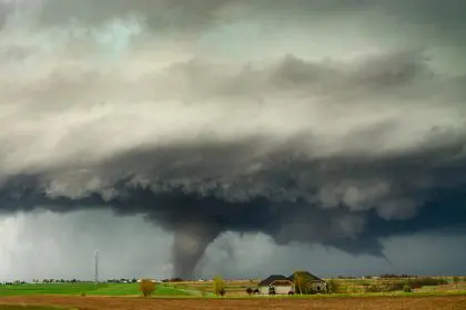
Weather tracking technology reveals that this disturbance has already begun showing signs of organization, with satellite imagery displaying the telltale spiral patterns that often precede tropical storm formation. The system’s slow movement means that any communities in its path could face prolonged periods of dangerous weather conditions.
The geographic scope of this weather threat encompasses some of the most densely populated vacation areas in the southeastern United States, potentially affecting millions of people who have planned special Fourth of July celebrations in the region.
Holiday weekend impact predictions
The approaching storm system threatens to deliver a triple threat of hazardous conditions that could make outdoor Fourth of July celebrations extremely dangerous. Heavy rainfall, gusty winds, and rough surf conditions are all expected to develop as the system continues to organize and strengthen over the warm waters.
Coastal areas face particularly severe risks, with dangerous rip currents and rough surf conditions expected to develop along both the Gulf and Atlantic coasts. These conditions pose serious threats to beachgoers and swimmers, making popular beach destinations potentially unsafe for the holiday crowds that typically flock to these areas.
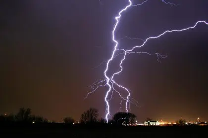
Wind conditions associated with the storm could make outdoor grilling, fireworks displays, and other traditional Fourth of July activities hazardous or impossible. The combination of gusty winds and heavy rain creates perfect conditions for power outages, which could further complicate holiday celebrations and emergency response efforts.
The storm’s timing threatens to impact not just individual family celebrations but also major public events and festivals scheduled throughout the region. Many communities may be forced to cancel or postpone their planned fireworks displays and outdoor concerts, disappointing thousands of attendees who have been looking forward to these annual traditions.
Current development status and projections
As of the latest meteorological assessments, this weather system maintains a relatively low probability of immediate tropical development, but conditions remain highly favorable for strengthening over the coming days. The warm ocean temperatures and reduced wind shear in the region create an environment where rapid intensification could occur with little warning.
If the system does strengthen into a named storm, it would become Chantal, the third named storm of the 2025 Atlantic hurricane season. This early-season activity follows the recent formation of Tropical Storm Barry, which made landfall in Mexico before weakening into a remnant low pressure system.
The storm’s development timeline suggests that the most significant impacts could arrive just as Fourth of July celebrations reach their peak, maximizing the potential disruption to holiday plans. Weather models indicate that the system could maintain its strength and position through the entire holiday weekend, creating prolonged periods of dangerous conditions.
Formation probabilities continue to increase as the system encounters increasingly favorable atmospheric conditions. The combination of warm water temperatures, low wind shear, and the stalling frontal boundary creates optimal conditions for tropical cyclone development.
Geographic areas at greatest risk
The storm’s expansive reach threatens to impact a vast geographic area stretching from the Alabama and Mississippi Gulf Coast through Florida and up the Atlantic seaboard to the Carolinas. This broad impact zone encompasses some of the nation’s most popular Fourth of July destinations, including numerous beach communities and resort areas.
Northern Florida faces particularly high risks due to the system’s projected path and intensity. The region’s extensive coastline and numerous inland waterways could experience significant flooding, especially in low-lying areas that are already vulnerable to storm surge and heavy rainfall.
Gulf Coast communities from the Florida Panhandle through Alabama and Mississippi should prepare for dangerous surf conditions and the possibility of tropical storm-force winds. These areas have experienced significant storm impacts in recent years, making residents particularly aware of the importance of preparation and early action.
Atlantic Coast areas from northeast Florida through the Carolinas face threats from rough surf, rip currents, and the potential for coastal flooding. Popular beach destinations like Myrtle Beach, Outer Banks, and coastal Georgia could see their busy Fourth of July tourism season disrupted by dangerous conditions.
Preparation recommendations for affected areas
Residents and visitors in potentially affected areas should begin making alternative plans for their Fourth of July celebrations immediately. Indoor venues, covered pavilions, and other protected spaces should be secured as backup locations for gatherings that were originally planned for outdoor settings.
Emergency supply preparations should include extra water, non-perishable food, flashlights, batteries, and battery-powered or hand-crank radios. Power outages are possible with any significant storm system, and having adequate supplies can make the difference between minor inconvenience and serious hardship.
Beach safety becomes paramount as the storm approaches, with authorities strongly recommending that swimmers and surfers avoid the water entirely once dangerous conditions develop. Rip currents and rough surf can create life-threatening situations even for experienced water enthusiasts.
Travel plans should be reviewed and potentially modified, especially for those planning to drive through areas likely to experience heavy rainfall and strong winds. Hydroplaning conditions and reduced visibility can make highway travel extremely dangerous during storm events.
Historical context and seasonal patterns
July represents a particularly active period for tropical development in the Atlantic basin, with storms frequently forming close to the United States rather than developing from African tropical waves that characterize the peak season months. This pattern makes early detection and preparation especially critical for coastal communities.
The 2025 Atlantic hurricane season has already shown signs of increased activity, with forecasters predicting an above-average season that could bring multiple significant storms to the U.S. coastline. This early-season activity often sets the tone for what communities can expect throughout the remainder of the hurricane season.
Florida’s unique geographic position makes it particularly vulnerable to storms that develop in the Gulf of Mexico or form along the Atlantic seaboard. The state’s extensive coastline and low elevation create multiple pathways for storm impacts, whether from direct landfall or prolonged exposure to tropical storm conditions.
Weather patterns this summer have created conditions that favor tropical development, including warmer-than-average ocean temperatures and atmospheric patterns that reduce the wind shear that typically inhibits storm formation. These conditions suggest that the current system may be just the beginning of an active period for the region.
Safety measures and emergency preparedness
Local emergency management agencies throughout the potential impact zone are closely monitoring the storm’s development and preparing to activate emergency response protocols if conditions warrant. Residents should stay informed about local emergency procedures and evacuation routes in case conditions deteriorate rapidly.
Communication plans become essential when severe weather threatens, as power outages and cell tower damage can disrupt normal communication channels. Families should establish meeting points and contact procedures that don’t rely solely on electronic communication methods.
Outdoor furniture, decorations, and other loose items should be secured or brought indoors before dangerous winds arrive. These items can become dangerous projectiles in strong winds, posing threats to both property and personal safety.
Medical needs require special attention during storm events, with individuals dependent on electricity for medical equipment or refrigerated medications needing to make alternative arrangements. Emergency shelters may not be equipped to handle specialized medical needs, making personal preparation essential.
Looking ahead: Long-term implications
The development of this storm system highlights the increasing importance of flexible planning for outdoor events during hurricane season. Climate patterns suggest that such disruptions may become more common, requiring communities and event planners to develop more robust contingency plans.
Tourism industries throughout the southeastern United States are closely watching this storm’s impact, as Fourth of July weekend represents one of the most important revenue periods of the year. Significant storm impacts could have economic consequences that extend well beyond the immediate weather event.
The storm’s timing and trajectory serve as a reminder that hurricane season preparedness cannot be delayed or taken lightly. Early-season storms often catch communities and individuals unprepared, making proactive planning and preparation essential for minimizing impacts.
As this weather system continues to develop, its ultimate impact will depend on a complex interaction of atmospheric and oceanic factors that remain difficult to predict with complete accuracy. The key for residents and visitors in potentially affected areas is to remain informed, prepared, and flexible as conditions continue to evolve throughout the holiday weekend.