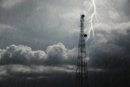
Millions of Americans across the central United States are preparing for a potentially devastating week of severe weather as meteorologists track multiple storm systems capable of producing destructive tornadoes, baseball-sized hail, and life-threatening flash floods. The weather pattern will impact more than a dozen states from Wisconsin to Texas, creating widespread disruption to daily life and threatening property damage.
The approaching storm systems represent a continuation of the active severe weather season that has already battered several states during late May. Colorado, Texas, Louisiana, and Georgia experienced significant storm damage between May 26 and 30, with communities still recovering from previous rounds of destructive weather events.
Weather experts emphasize that while this week’s storms may not reach the intensity of a major outbreak, the widespread nature of the threat means millions of people will face potentially dangerous conditions. The combination of multiple storm rounds over several days increases the likelihood of cumulative impacts, including prolonged power outages and transportation disruptions.
Tuesday brings first wave of destructive storms
The initial storm threat will emerge Tuesday across a vast corridor stretching from southwestern Wisconsin and western Illinois down to northern Texas. This expansive zone places major metropolitan areas including Kansas City, Oklahoma City, and Dallas directly in the path of potentially severe thunderstorms.
Meteorologists identify the area from central Oklahoma to southern Missouri as facing the highest risk for the most intense storms on Tuesday. This region could experience the dangerous combination of large hail, damaging winds exceeding 70 miles per hour, and isolated tornadoes capable of causing significant structural damage.
The storms will develop during the afternoon and evening hours when atmospheric instability typically reaches its peak. Residents in the affected areas should monitor weather conditions closely and be prepared to take shelter quickly if severe weather warnings are issued for their location.
Atmospheric conditions create perfect storm scenario
Multiple meteorological factors are converging to create ideal conditions for severe weather development throughout the week. The jet stream, a fast-moving river of air in the upper atmosphere, is strengthening over the Plains states, providing the necessary wind shear to organize thunderstorms into potentially dangerous systems.
Simultaneously, warm and humid air from the Gulf of Mexico is flowing northward, creating the moisture and instability that fuel severe thunderstorm development. This combination of wind shear and atmospheric instability represents the classic setup for supercell thunderstorms, which can produce the most destructive weather phenomena.
The persistence of these atmospheric patterns means that storm development will continue through multiple days rather than representing a single weather event. This extended timeframe increases the overall threat level as communities may face repeated rounds of severe weather with limited recovery time between events.
Wednesday expands threat zone dramatically
The storm threat will expand significantly on Wednesday, with severe weather possible across more than 1,000 miles from Detroit through Dallas. This massive geographic scope means that tens of millions of Americans will face potential weather hazards during the middle of the week.
The primary threats on Wednesday will include large hail capable of damaging vehicles and structures, gusty winds that can down trees and power lines, and flash flooding in areas with poor drainage or recent heavy rainfall. The widespread nature of the threat means that multiple states will likely experience simultaneous severe weather events.
Urban areas face particular challenges during widespread severe weather events due to the potential for power grid failures affecting large populations. Cities within the threat zone should prepare emergency response resources and ensure that residents understand severe weather safety procedures.
Flooding concerns compound storm dangers
Beyond the immediate threats of hail and tornadoes, flooding represents a significant concern throughout the affected region. Areas that received above-average rainfall during May face elevated risks of flash flooding when new storms arrive this week.
Springfield, Missouri exemplifies the flooding concern after receiving 7.57 inches of rain in May, with more than half that total falling in just three days. Rivers and streams throughout central and southern Missouri, southeastern Kansas, and Oklahoma remain elevated from recent precipitation, making these areas particularly vulnerable to additional rainfall.
The combination of saturated soils and elevated waterways means that even moderate rainfall amounts could trigger significant flooding in some locations. Low-lying areas, poor drainage zones, and regions near rivers or streams face the highest risk of dangerous flood conditions.
Drought relief comes with dangerous trade-offs
While the severe weather threat dominates headlines, parts of the central United States will welcome the rainfall for drought relief purposes. Some areas experiencing developing drought conditions will benefit from the moisture, though the delivery method creates obvious safety concerns.
The challenge lies in receiving beneficial rainfall without experiencing the destructive aspects of severe thunderstorms. Unfortunately, the atmospheric setup that produces drought-relieving precipitation often coincides with conditions that generate dangerous weather phenomena.
Agricultural regions facing drought stress will particularly benefit from widespread rainfall, though farmers must balance the need for moisture against the risks of crop damage from hail or flooding. The timing of severe weather during growing season adds complexity to the overall impact assessment.
Extended weather pattern threatens weekend plans
The severe weather threat will not end midweek, with additional storm systems expected to affect the central United States through the weekend. A new cold front approaching the Plains by Saturday could regenerate severe weather conditions in parts of the region that may still be recovering from earlier storm impacts.
This extended active pattern means that residents should prepare for potentially disrupted weekend plans and ongoing weather vigilance through the end of the week. Multiple rounds of severe weather can strain emergency response resources and complicate recovery efforts from earlier storm damage.
The persistence of active weather patterns also increases the likelihood of cumulative impacts, where repeated storm systems cause progressively more significant damage to infrastructure and communities. Power companies and emergency management agencies are preparing for extended response operations.
Safety preparations essential for affected regions
Residents throughout the threat zone should take immediate steps to prepare for severe weather impacts. This includes reviewing family emergency plans, ensuring access to weather alerts, and identifying safe shelter locations both at home and work.
Mobile homes, vehicles, and temporary structures offer inadequate protection during severe thunderstorms and tornadoes. People in these situations should identify sturdy buildings where they can take shelter quickly when severe weather threatens their area.
Emergency supply kits should include battery-powered radios, flashlights, first aid supplies, and enough water and non-perishable food for several days. Power outages commonly accompany severe weather events, and restoration efforts may take days in areas experiencing significant damage.
Economic implications of widespread storm damage
The potential for severe weather across such a large geographic area raises concerns about economic impacts beyond immediate property damage. Transportation networks, including highways and airports, may experience significant disruptions that affect commerce and travel throughout the region.
Agricultural impacts could be substantial if storms produce large hail during critical growing periods. Crop insurance claims and commodity price fluctuations often follow significant weather events in major agricultural regions like those under threat this week.
The insurance industry closely monitors severe weather forecasts due to the potential for billions of dollars in claims from a single major storm system. The widespread nature of this week’s threat increases the potential for significant insurance payouts across multiple states and property types.
Climate patterns suggest continued active season
The current severe weather outbreak fits within broader seasonal patterns that suggest continued active weather throughout the summer months. La Nina conditions and other climate factors often contribute to enhanced severe weather activity across the central United States during late spring and early summer.
Long-range forecasts indicate that the atmospheric patterns supporting severe weather development may persist for several more weeks, potentially leading to additional significant storm threats throughout June and July. Communities should prepare for an extended period of heightened weather awareness and readiness.


