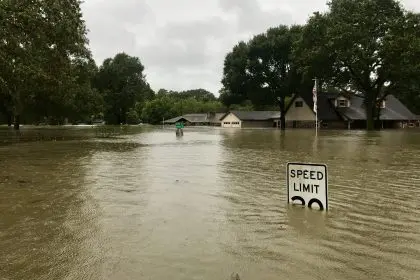
Residents across Uvalde County, Texas, are seeking higher ground as the Frio River surges to dangerous levels, rising an alarming 16 feet above normal following intense overnight rainfall that has transformed the usually peaceful waterway into a potentially deadly threat.
The National Weather Service has issued flash flood warnings for the communities of Leakey and Concan, with officials urging anyone living along the river to evacuate immediately. The emergency situation began developing in the early morning hours when a powerful storm system moved through the region, dumping between 5 and 6 inches of rain across a widespread area.
Emergency unfolds in pre-dawn hours
The crisis began around 3 a.m. when a storm system approached from the southwest, bringing torrential rains that would continue throughout the morning. The relentless downpour affected not only Uvalde County but extended into Real County, creating a cascading effect as tributaries and creeks began overflowing their banks.
Brett Rimkus, President at Garner Park Concessions, witnessed the dramatic transformation of the landscape as the weather system intensified. The storm’s path covered the northern portion of Uvalde County, where the accumulated rainfall quickly overwhelmed the area’s drainage capacity.
Emergency response teams mobilized swiftly as reports of rising water levels began flooding in from across the region. The coordinated effort involved multiple agencies working together to monitor conditions and assist residents in affected areas.
Widespread road closures create travel chaos
The flooding has forced authorities to close numerous roads throughout the region, creating significant disruptions for residents and travelers. Among the most critically affected areas is the B and R Crossing at the 26500 block of FM 187 in Utopia, where water levels have made passage impossible.
Thompson Road at FM 187 has also been shuttered, along with Panther Hill Road and Cornelius Road at the same intersection. Old Mill Creek Road remains impassable, while the Sabinal Bridge at FM 187, located just south of the Lost Maples Recreational Area, poses particular dangers to motorists.
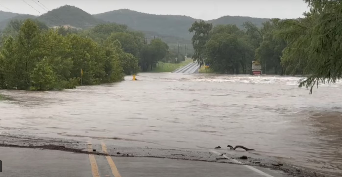
Additional complications arose when a large boulder was reported blocking the eastbound lane at the 17000 block of FM 337, adding geological hazards to the already dangerous flooding conditions. The Texas Department of Transportation continues monitoring the situation, with crews prepared to implement additional closures as needed.
River reaches major flood stage
The Frio River at Concan and the section below Dry Frio near Uvalde have both reached major flood stage, according to National Weather Service forecasts. This designation indicates that the flooding poses significant threats to life and property, requiring immediate action from residents in affected areas.
Water levels in some locations are expected to rise between 10 and 12 feet, with certain areas potentially seeing increases of up to 15 feet. The dramatic rise creates particularly dangerous conditions in lower-lying areas where additional tributaries converge between Garner State Park and Concan.
The unprecedented water levels have transformed familiar landscapes into unrecognizable flood zones, with normally shallow crossing points now becoming treacherous torrents. Emergency officials emphasize that even experienced locals should avoid attempting to cross flooded areas.
Community response and safety measures
Local emergency management teams have praised the coordinated response effort, with communication systems functioning effectively despite the challenging conditions. The Delta Canyon area has seen particularly strong cooperation between emergency responders and local residents.
Concan Fire and EMS issued urgent warnings through social media, alerting residents to the rapidly changing conditions and emphasizing the need for immediate evacuation from low-lying areas. The 10-foot rise near North Concan represents just one of several critical monitoring points along the river system.
Ongoing weather concerns
The National Weather Service extended flash flood warnings until 1:30 p.m., though conditions remain fluid as rainfall continues across the region. The extended timeline reflects meteorologists’ concerns about additional precipitation potentially exacerbating already dangerous conditions.
Officials stress that residents should not attempt to drive through flooded roadways, as even vehicles with high clearance can be swept away by fast-moving water. The combination of debris, strong currents, and reduced visibility makes any travel through flooded areas extremely hazardous.
The situation continues developing throughout the day, with emergency crews maintaining constant vigilance as water levels fluctuate and weather conditions evolve across south-central Texas.